
Mapa topográfico Oujé-Bougoumou (Land)
Mapa interativo
Clique no mapa para exibir a altitude.
Sobre este mapa
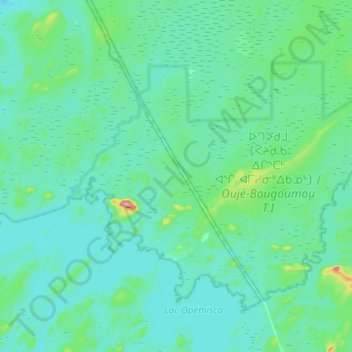
Nome: Mapa topográfico Oujé-Bougoumou (Land), altitude, relevo.
Altitude média: 372 m
Altitude mínima: 349 m
Altitude máxima: 538 m
Outros mapas topográficos
Clique em um mapa para visualizar sua topografia, sua altitude e seu relevo.
Roggan River
Canada > Quebec > Eeyou Istchee
Roggan River, Eeyou Istchee, Northern Quebec, Quebec, Canada
Altitude média: 8 m
Lac Margie
Canada > Quebec > Eeyou Istchee
Lac Margie, Eeyou Istchee, Northern Quebec, Quebec, Canada
Altitude média: 318 m
Waswanipi (Land)
Canada > Quebec > Eeyou Istchee
Waswanipi (Land), Eeyou Istchee, Northern Quebec, Quebec, J0Y 3C0, Canada
Altitude média: 314 m
Mistissini
Canada > Quebec > Eeyou Istchee > Mistissini (Land)
Mistissini, Mistissini (Land), Eeyou Istchee, Nord-du-Québec, Quebec, G0W 1C0, Canada
Altitude média: 388 m
Chisasibi (Village)
Canada > Quebec > Eeyou Istchee > Chisasibi (Village)
Chisasibi (Village), Eeyou Istchee, Northern Quebec, Quebec, Canada
Altitude média: 96 m
Whapmagoostui (Category I Land)
Canada > Quebec > Eeyou Istchee > Whapmagoostui (Village)
Whapmagoostui (Category I Land), Whapmagoostui (Village), Eeyou Istchee, Northern Quebec, Quebec, Canada
Altitude média: 91 m
ᐙᔅᑳᐦᐄᑲᓂᔥ Waskaganish
Canada > Quebec > Eeyou Istchee > Waskaganish (Land) > ᐙᔅᑳᐦᐄᑲᓂᔥ Waskaganish
ᐙᔅᑳᐦᐄᑲᓂᔥ Waskaganish, Waskaganish (Land), Eeyou Istchee, Northern Quebec, Quebec, Canada
Altitude média: 15 m
Whapmagoostui (Village)
Canada > Quebec > Eeyou Istchee
Whapmagoostui (Village), Eeyou Istchee, Nord-du-Québec, Quebec, Canada
Altitude média: 101 m