
Mapa topográfico Gisikon
Mapa interativo
Clique no mapa para exibir a altitude.
Sobre este mapa
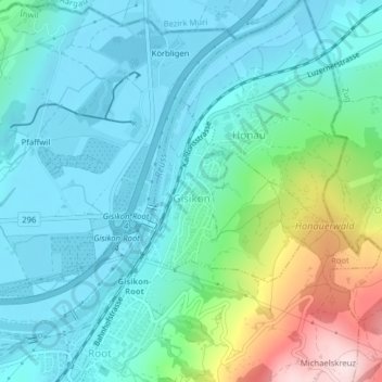
Nome: Mapa topográfico Gisikon, altitude, relevo.
Local: Gisikon, Lucerne, 6038, Switzerland (47.12038 8.39505 47.13319 8.41389)
Altitude média: 488 m
Altitude mínima: 403 m
Altitude máxima: 791 m
Outros mapas topográficos
Clique em um mapa para visualizar sua topografia, sua altitude e seu relevo.
Schloss Meggenhorn
Switzerland > Lucerne > Meggen
Schloss Meggenhorn, 53, Meggenhornstrasse, Lerchenbühl, Meggen, Lucerne, 6045, Switzerland
Altitude média: 450 m
Allmendhubel
Switzerland > Lucerne > Menznau
Allmendhubel, Allmend, Menznau, Lucerne, 6122, Switzerland
Altitude média: 636 m
Schachen
Switzerland > Lucerne > Werthenstein > Schachen
Schachen, Werthenstein, Lucerne, 6105, Switzerland
Altitude média: 671 m