
Mapa topográfico Mahendragiri
Mapa interativo
Clique no mapa para exibir a altitude.
Sobre este mapa
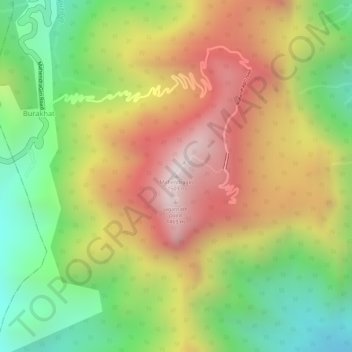
Nome: Mapa topográfico Mahendragiri, altitude, relevo.
Altitude média: 1108 m
Altitude mínima: 711 m
Altitude máxima: 1494 m
Mahendragiri, is a mountain in Rayagada block of the district of Gajapati, Odisha, India. It is situated amongst the Eastern Ghats at an elevation of 1,501 metres (4,925 ft).It is second biodiversity Heritage Site of Odisha. This is considered as one out of Seven Kula Parvat of India.
Outros mapas topográficos
Clique em um mapa para visualizar sua topografia, sua altitude e seu relevo.
Eastern Ghats
India > Odisha > Ramagiri > Burakhat
Eastern Ghats, Burakhat, Ramagiri, Gajapati District, Odisha, India
Altitude média: 1130 m