
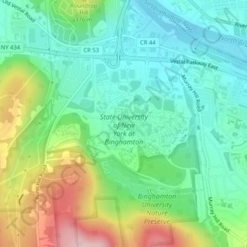
Mapa topográfico State University of New York at Binghamton
Mapa interativo
Clique no mapa para exibir a altitude.
Sobre este mapa
Nome: Mapa topográfico State University of New York at Binghamton, altitude, relevo.
Altitude média: 320 m
Altitude mínima: 246 m
Altitude máxima: 482 m
Outros mapas topográficos
Clique em um mapa para visualizar sua topografia, sua altitude e seu relevo.
Kopernik Observatory & Science Center
United States > New York > Broome County > Town of Vestal > Tracy Creek
Kopernik Observatory & Science Center, 698, Underwood Road, Tracy Creek, Town of Vestal, Broome County, New York, 13850, United States
Altitude média: 452 m
Ross Corners
United States > New York > Broome County > Town of Vestal
Ross Corners, Town of Vestal, Broome County, New York, United States
Altitude média: 304 m