
Mapa topográfico Dymchurch
Mapa interativo
Clique no mapa para exibir a altitude.
Sobre este mapa
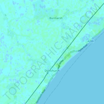
Nome: Mapa topográfico Dymchurch, altitude, relevo.
Local: Dymchurch, Folkestone and Hythe, Kent, Angleterre, Royaume-Uni (51.01210 0.96874 51.05647 1.03525)
Altitude média: 1 m
Altitude mínima: -2 m
Altitude máxima: 6 m
Outros mapas topográficos
Clique em um mapa para visualizar sua topografia, sua altitude e seu relevo.
Folkestone
Royaume-Uni > Angleterre > Kent > Folkestone and Hythe
Folkestone, Folkestone and Hythe, Kent, Angleterre, Royaume-Uni
Altitude média: 62 m
Postling
Royaume-Uni > Angleterre > Kent > Folkestone and Hythe
Postling, Folkestone and Hythe, Kent, Angleterre, Royaume-Uni
Altitude média: 112 m