
Mapa topográfico Nederweert
Mapa interativo
Clique no mapa para exibir a altitude.
Sobre este mapa
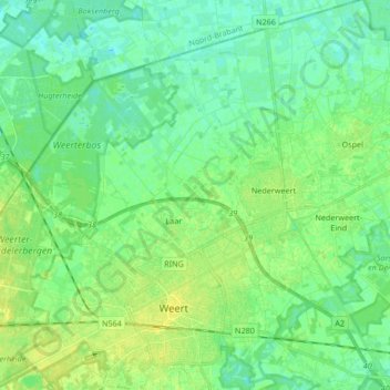
Nome: Mapa topográfico Nederweert, altitude, relevo.
Local: Nederweert, Limburg, Nederland (51.23692 5.64400 51.33184 5.81170)
Altitude média: 32 m
Altitude mínima: 25 m
Altitude máxima: 40 m
Outros mapas topográficos
Clique em um mapa para visualizar sua topografia, sua altitude e seu relevo.
Nationaal Park De Groote Peel
Nederland > Limburg > Nederweert
Nationaal Park De Groote Peel, 10e baan, Ospel, Nederweert, Limburg, Nederland, 6035RM, Nederland
Altitude média: 29 m
Schoor
Nederland > Limburg > Nederweert > Schoor
Schoor, Nederweert, Limburg, Nederland, 6031, Nederland
Altitude média: 33 m