
Mapa topográfico Marshall County
Mapa interativo
Clique no mapa para exibir a altitude.
Sobre este mapa
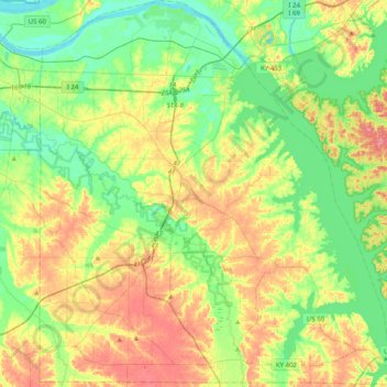
Nome: Mapa topográfico Marshall County, altitude, relevo.
Local: Marshall County, Kentucky, United States (36.74634 -88.48572 37.06598 -88.11082)
Altitude média: 126 m
Altitude mínima: 92 m
Altitude máxima: 179 m
Outros mapas topográficos
Clique em um mapa para visualizar sua topografia, sua altitude e seu relevo.
Gilbertsville
United States > Kentucky > Marshall County
Gilbertsville, Marshall County, Kentucky, United States
Altitude média: 104 m
Scale
United States > Kentucky > Marshall County
Scale, Marshall County, Kentucky, 42025, United States
Altitude média: 129 m