
Mapa topográfico Golts
Mapa interativo
Clique no mapa para exibir a altitude.
Sobre este mapa
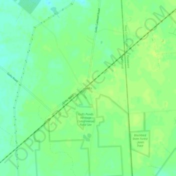
Nome: Mapa topográfico Golts, altitude, relevo.
Local: Golts, Kent County, Maryland, United States (39.31678 -75.79466 39.35678 -75.75466)
Altitude média: 22 m
Altitude mínima: 14 m
Altitude máxima: 27 m
Outros mapas topográficos
Clique em um mapa para visualizar sua topografia, sua altitude e seu relevo.
Still Pond
United States > Maryland > Kent County
Still Pond, Kent County, Maryland, 21667, United States
Altitude média: 21 m
Langford Bay Estates
United States > Maryland > Kent County
Langford Bay Estates, Kent County, Maryland, United States
Altitude média: 4 m