
Mapa topográfico Old Weston
Mapa interativo
Clique no mapa para exibir a altitude.
Sobre este mapa
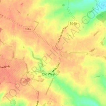
Nome: Mapa topográfico Old Weston, altitude, relevo.
Altitude média: 65 m
Altitude mínima: 36 m
Altitude máxima: 78 m
Outros mapas topográficos
Clique em um mapa para visualizar sua topografia, sua altitude e seu relevo.
Huntingdon
United Kingdom > England > Cambridgeshire > Huntingdonshire
Huntingdon, Godmanchester, Huntingdonshire, Cambridgeshire, Cambridgeshire and Peterborough, England, United Kingdom
Altitude média: 25 m
Godmanchester
United Kingdom > England > Cambridgeshire > Huntingdonshire > Godmanchester
Godmanchester, Huntingdonshire, Cambridgeshire, East of England, England, United Kingdom
Altitude média: 22 m