
Mapa topográfico Nizhny Tagil
Mapa interativo
Clique no mapa para exibir a altitude.
Sobre este mapa
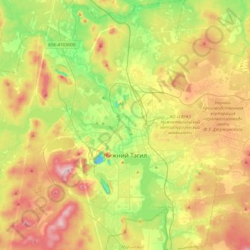
Nome: Mapa topográfico Nizhny Tagil, altitude, relevo.
Altitude média: 234 m
Altitude mínima: 121 m
Altitude máxima: 377 m
Rivers and ponds take up one third of the city's territory. Nizhny Tagil spans 22 kilometers (14 mi) from north to south and 21 kilometers (13 mi) from east to west. The altitude of the city varies from 170 to 380 meters (560 to 1,250 ft).
Outros mapas topográficos
Clique em um mapa para visualizar sua topografia, sua altitude e seu relevo.
Тагил
Russia > Sverdlovsk Oblast > городской округ Нижний Тагил > Nizhny Tagil
Тагил, Выя, Ленинский район, Nizhny Tagil, городской округ Нижний Тагил, Sverdlovsk Oblast, Ural Federal District, 622001, Russia
Altitude média: 203 m