
Mapa topográfico Westminster Park
Mapa interativo
Clique no mapa para exibir a altitude.
Sobre este mapa
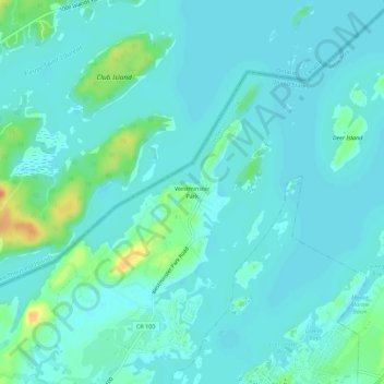
Nome: Mapa topográfico Westminster Park, altitude, relevo.
Local: Westminster Park, Jefferson County, New York, 13607, USA (44.33616 -75.94968 44.37616 -75.90968)
Altitude média: 79 m
Altitude mínima: 71 m
Altitude máxima: 110 m
Outros mapas topográficos
Clique em um mapa para visualizar sua topografia, sua altitude e seu relevo.
Mary Island State Park
USA > New York > Westminster Park
Mary Island State Park, Westminster Park, Jefferson County, New York, USA
Altitude média: 76 m