Geolocalizar

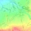
Mapa topográfico Wymott

Clique no mapa para exibir a altitude.

Sobre este mapa
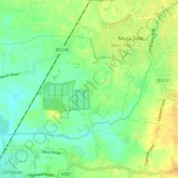
Nome: Mapa topográfico Wymott, altitude, relevo.

Local: Wymott, Ulnes Walton, Chorley, Lancashire, England, PR26 8NH, United Kingdom (53.66088 -2.76627 53.70088 -2.72627)

Altitude média: 17 m

Altitude mínima: 5 m

Altitude máxima: 31 m

Outros mapas topográficos

Clique em um mapa para visualizar sua topografia, sua altitude e seu relevo.
River Darwen

United Kingdom > England > Lancashire > Chorley

Altitude média: 123 m

Rivington

United Kingdom > England > Lancashire > Chorley > Rivington

Altitude média: 244 m

Bretherton

United Kingdom > England > Lancashire > Chorley

Altitude média: 10 m

Wheelton

United Kingdom > England > Lancashire > Chorley > Brinscall

Altitude média: 183 m

Coppull

United Kingdom > England > Lancashire > Chorley

The settlement has an Anglo Saxon name describing its topography derived from the Old English copp a hill top and hyll a hill. The township was variously recorded as Cophull and Cophulle in 1277, Copphull in 1351, Copthull in 1374 and Coppull from 1444.

Altitude média: 82 m
Brindle

United Kingdom > England > Lancashire > Chorley > Brindle

Altitude média: 114 m

Heskin

United Kingdom > England > Lancashire > Chorley

Altitude média: 56 m

Euxton

United Kingdom > England > Lancashire > Chorley > Euxton

Altitude média: 50 m

Adlington

United Kingdom > England > Lancashire > Chorley > Adlington

Altitude média: 95 m

Moss Wood

United Kingdom > England > Lancashire > Chorley

Altitude média: 8 m

Hoghton

United Kingdom > England > Lancashire > Chorley > Hoghton

Altitude média: 104 m

Heapey

United Kingdom > England > Lancashire > Chorley > Wheelton

Altitude média: 127 m

Croston

United Kingdom > England > Lancashire > Chorley

Altitude média: 8 m

Coppull

United Kingdom > England > Lancashire > Chorley

The settlement has an Anglo Saxon name describing its topography derived from the Old English copp a hill top and hyll a hill. The township was variously recorded as Cophull and Cophulle in 1277, Copphull in 1351, Copthull in 1374 and Coppull from 1444.

Altitude média: 80 m

Prepare-se para a sua próxima aventura:

🎒Mochilas de Trekking e Expedição - Mochilas ergonómicas com capacidade para equipamento de vários dias
🌄Acessórios de Fotografia Outdoor - Capturar aventuras
🛌Almofadas de Viagem Compactas - Conforto cervical para dormir em qualquer lugar
🚁Drones com Câmara 4K e GPS - Para mapeamento aéreo e visualização de topografia de difícil acesso
🧗Bastões de Caminhada - Estabilidade e redução de impacto

Como Associado da Amazon, este site recebe uma comissão sobre compras elegíveis sem custo adicional para si.