
Mapa topográfico Hastings
Mapa interativo
Clique no mapa para exibir a altitude.
Sobre este mapa
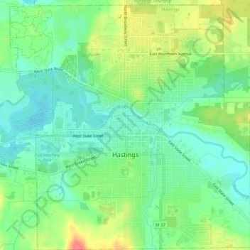
Nome: Mapa topográfico Hastings, altitude, relevo.
Local: Hastings, Barry County, Michigan, 49058, United States (42.63167 -85.31422 42.66878 -85.26562)
Altitude média: 252 m
Altitude mínima: 229 m
Altitude máxima: 291 m
Outros mapas topográficos
Clique em um mapa para visualizar sua topografia, sua altitude e seu relevo.
Hastings Township
United States > Michigan > Barry County
Hastings Township, Barry County, Michigan, United States
Altitude média: 265 m
Thornapple River
United States > Michigan > Barry County > Irving
Thornapple River, Irving, Irving Township, Barry County, Michigan, United States
Altitude média: 236 m
Gun Lake
United States > Michigan > Barry County
Gun Lake, Yankee Springs Township, Barry County, Michigan, United States
Altitude média: 234 m