
Mapa topográfico Red Hill Fire Tower
Mapa interativo
Clique no mapa para exibir a altitude.
Red Hill Fire Tower
The cabin is a small, one-story, 14-by-24-foot (4.3 by 7.3 m) gable-roofed frame building. It is sided with "brainstorm", edge board stained reddish brown. It has a mortared rubblestone foundation and a covered porch on the south elevation, originally decked in wood but since replaced with concrete. Built in 1931, it is one of the oldest remaining observer's cabins in New York, a rare intact example of the earlier style used by the then-state Conservation Commission.
Sobre este mapa
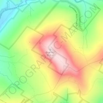
Nome: Mapa topográfico Red Hill Fire Tower, altitude, relevo.
Altitude média: 713 m
Altitude mínima: 537 m
Altitude máxima: 906 m