
Mapa topográfico Dhandhuka
Mapa interativo
Clique no mapa para exibir a altitude.
Dhandhuka
Dhandhuka is located at 22°22′N 71°59′E / 22.37°N 71.98°E / 22.37; 71.98. It has an average elevation of 24 metres (78 feet). The city is 105 km from District center Ahmedabad, on state highway No 1. to Bhavnagar. Bhavnagar is 95 km from Dhandhuka town.
Sobre este mapa
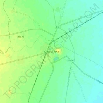
Nome: Mapa topográfico Dhandhuka, altitude, relevo.
Altitude média: 21 m
Altitude mínima: 13 m
Altitude máxima: 30 m