
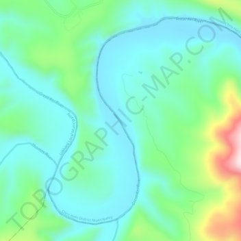
Mapa topográfico Great Kei River
Mapa interativo
Clique no mapa para exibir a altitude.
Sobre este mapa
Nome: Mapa topográfico Great Kei River, altitude, relevo.
Altitude média: 620 m
Altitude mínima: 508 m
Altitude máxima: 986 m
Outros mapas topográficos
Clique em um mapa para visualizar sua topografia, sua altitude e seu relevo.
Kubusi
RSA > Eastern Cape > Amahlathi Local Municipality
Kubusi, Amahlathi Local Municipality, Amathole District Municipality, Eastern Cape, RSA
Altitude média: 1397 m
Mount Kempt
RSA > Eastern Cape > Amahlathi Local Municipality
Mount Kempt, Amahlathi Local Municipality, Amathole District Municipality, Eastern Cape, RSA
Altitude média: 1166 m
Waterdown Dam
RSA > Eastern Cape > Amahlathi Local Municipality
Waterdown Dam, R67, Amahlathi Ward 4, Amahlathi Local Municipality, Amathole District Municipality, Eastern Cape, RSA
Altitude média: 1269 m