
Mapa topográfico Donnelly
Mapa interativo
Clique no mapa para exibir a altitude.
Sobre este mapa
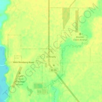
Nome: Mapa topográfico Donnelly, altitude, relevo.
Local: Donnelly, Valley County, Idaho, United States (44.72257 -116.09364 44.74549 -116.06739)
Altitude média: 1483 m
Altitude mínima: 1469 m
Altitude máxima: 1488 m
Donnelly is located at 44°43′49″N 116°4′37″W / 44.73028°N 116.07694°W / 44.73028; -116.07694, at an elevation of 4,865 feet (1,483 m) above sea level. According to the United States Census Bureau, the city has a total area of 0.45 square miles (1.17 km2), all of it land.
Outros mapas topográficos
Clique em um mapa para visualizar sua topografia, sua altitude e seu relevo.
Cascade
United States > Idaho > Valley County
Cascade, Valley County, Idaho, 83611, United States
Altitude média: 1478 m
McCall
United States > Idaho > Valley County
McCall, Valley County, Idaho, 83638, United States
Altitude média: 1546 m