Mapa topográfico Bikaner
Clique no mapa para exibir a altitude.
Bikaner
Around a century after Rao Bika founded Bikaner, the state's fortunes flourished under the sixth Raja, Rai Singhji, who ruled from 1571 to 1611. During the Mughal Empire's rule in the country, Raja Rai Singh accepted the suzerainty of the Mughals and held a high rank as an army general at the court of the Emperor Akbar and his son the Emperor Jahangir. Rai Singh's successful military exploits, which involved winning half of Mewar kingdom for the Empire, won him accolades and rewards from the Mughal emperors. He was given the jagirs (lands) of Gujarat and Burhanpur. With the large revenue earned from these jagirs, he built the Chintamani Durg (Junagarh fort) on a plain which has an average elevation of 760 feet (230 m). He was an expert in arts and architecture, and the knowledge he acquired during his visits abroad is amply reflected in the numerous monuments he built at the Junagarh fort.
Sobre este mapa
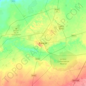
Nome: Mapa topográfico Bikaner, altitude, relevo.
Local: Bikaner, Bikaner Tehsil, Bikaner, Rajasthan, 334001, India (27.85593 73.15714 28.17593 73.47714)
Altitude média: 225 m
Altitude mínima: 185 m
Altitude máxima: 290 m
Outros mapas topográficos
Clique em um mapa para visualizar sua topografia, sua altitude e seu relevo.