
Mapa topográfico Stans
Mapa interativo
Clique no mapa para exibir a altitude.
Sobre este mapa
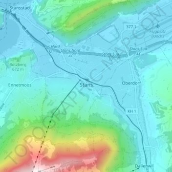
Nome: Mapa topográfico Stans, altitude, relevo.
Local: Stans, Nidwalden, Switzerland (46.93129 8.34166 46.98193 8.38875)
Altitude média: 658 m
Altitude mínima: 432 m
Altitude máxima: 1779 m
The area of Stans is 11.08 km2 (4.28 sq mi). Much of the land within the borders of Stans is agricultural (43.7%), while just over a third (36.5%) is forested. Of the remaining area, about 17% is settlements and less than 2.6% is unproductive (mountains, rivers or glaciers). The highest point within the borders of Stans is on the Stanserhorn and is 1,819 m (5,968 ft) above sea level. The lowest point is at Fronhofen where the elevation is 438 m (1,437 ft). The village square (Dorfplatz) has an elevation of 452 m (1,483 ft).