
Mapa topográfico Ramsloh
Mapa interativo
Clique no mapa para exibir a altitude.
Sobre este mapa
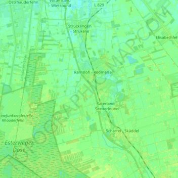
Nome: Mapa topográfico Ramsloh, altitude, relevo.
Altitude média: 6 m
Altitude mínima: 0 m
Altitude máxima: 10 m
Outros mapas topográficos
Clique em um mapa para visualizar sua topografia, sua altitude e seu relevo.
Sedelsberg
Deutschland > Niedersachsen > Landkreis Cloppenburg > Saterland
Sedelsberg, Saterland, Landkreis Cloppenburg, Niedersachsen, Deutschland
Altitude média: 7 m
Hollener See
Deutschland > Niedersachsen > Landkreis Cloppenburg > Saterland
Hollener See, Ramsloh, Saterland, Landkreis Cloppenburg, Niedersachsen, 26683, Deutschland
Altitude média: 6 m
Scharrel
Deutschland > Niedersachsen > Landkreis Cloppenburg > Saterland
Scharrel, Saterland, Landkreis Cloppenburg, Niedersachsen, Deutschland
Altitude média: 6 m