
Mapa topográfico Schellingwoude
Mapa interativo
Clique no mapa para exibir a altitude.
Sobre este mapa
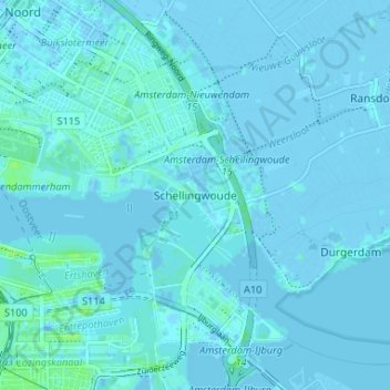
Nome: Mapa topográfico Schellingwoude, altitude, relevo.
Altitude média: 1 m
Altitude mínima: -4 m
Altitude máxima: 9 m
Outros mapas topográficos
Clique em um mapa para visualizar sua topografia, sua altitude e seu relevo.
Amsterdam
Niederlande > Nordholland > Amsterdam
Amsterdam, Nordholland, Niederlande
Altitude média: 0 m
Sloten
Niederlande > Nordholland > Amsterdam
Sloten, Amsterdam, Nordholland, Niederlande, 1066 CZ, Niederlande
Altitude média: 0 m
Oudeschans
Niederlande > Nordholland > Amsterdam
Oudeschans, Amsterdam, Nordholland, Niederlande, 1011 KX, Niederlande
Altitude média: 6 m