
Mapa topográfico Herongen
Mapa interativo
Clique no mapa para exibir a altitude.
Sobre este mapa
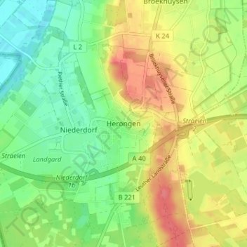
Nome: Mapa topográfico Herongen, altitude, relevo.
Altitude média: 45 m
Altitude mínima: 18 m
Altitude máxima: 78 m
Outros mapas topográficos
Clique em um mapa para visualizar sua topografia, sua altitude e seu relevo.
Holt
Deutschland > Nordrhein-Westfalen > Kreis Kleve > Straelen > Auwel
Holt, Auwel, Straelen, Kreis Kleve, Nordrhein-Westfalen, 47638, Deutschland
Altitude média: 32 m
Zand
Deutschland > Nordrhein-Westfalen > Kreis Kleve > Straelen
Zand, Straelen, Kreis Kleve, Nordrhein-Westfalen, 47638, Deutschland
Altitude média: 40 m