
Mapa topográfico Karakoram Pass
Mapa interativo
Clique no mapa para exibir a altitude.
Sobre este mapa
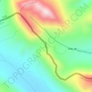
Nome: Mapa topográfico Karakoram Pass, altitude, relevo.
Local: Karakoram Pass, Nubra, Leh District, Ladakh, India (35.51341 77.82265 35.51351 77.82275)
Altitude média: 5521 m
Altitude mínima: 5300 m
Altitude máxima: 5931 m
Historically, the high altitude of the pass and the lack of fodder were responsible for the deaths of countless pack animals while the route was notorious for the trail of bones strewn along the way. There is an almost total absence of vegetation on the approaches to the pass.
Outros mapas topográficos
Clique em um mapa para visualizar sua topografia, sua altitude e seu relevo.
Siachen Glacier
Siachen Glacier, Nubra, Leh district, Ladakh, India
Altitude média: 5448 m
Daulat Beg Oldi
Daulat Beg Oldi, Nubra, Leh district, Ladakh, India
Altitude média: 5085 m