
Mapa topográfico Dena
Mapa interativo
Clique no mapa para exibir a altitude.
Sobre este mapa
Nome: Mapa topográfico Dena, altitude, relevo.
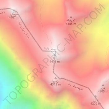
Altitude média: 3896 m
Altitude mínima: 2746 m
Altitude máxima: 4415 m
Mount Dena has more than 40 peaks higher than 4,000 metres (13,000 feet). With an elevation of 4,409 metres above sea level, Qash-Mastan is the highest peak in the Dena Range and in the Zagros Mountains in general. Another known peak in this range is Hose-Daal close to the city of Sisakht, 30 km (19 mi) to the north of Yasuj.