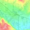
Mapa topográfico Windsor
Clique no mapa para exibir a altitude.
Windsor
Some days in the winter and spring can be warm and extremely dry, with Chinook winds often raising temperatures to near 70 °F (21 °C) in January and February, and sometimes to near 90 °F (32 °C) in April. Windsor's elevation and low year-round humidity means that nighttime low temperatures are practically never above 68 °F (20 °C), even in the very hottest part of the summer. The diurnal temperature range is usually rather wide, with a 50-degree (Fahrenheit) difference between daytime high and nighttime low not uncommon, especially in the spring and fall months. Rapid fluctuation in temperature is also common – a sunny 80 °F (27 °C) October afternoon can easily give way to a 28 °F (-2 °C) blizzard within 12 hours.
Sobre este mapa
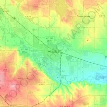
Nome: Mapa topográfico Windsor, altitude, relevo.
Local: Windsor, Weld County, Colorado, 80550, United States (40.40706 -104.99162 40.54367 -104.84189)
Altitude média: 1485 m
Altitude mínima: 1436 m
Altitude máxima: 1551 m
Outros mapas topográficos
Clique em um mapa para visualizar sua topografia, sua altitude e seu relevo.


Saint Vrain State Park
United States > Colorado > Weld County > Firestone
The land of St. Vrain State Park was originally home to Ute, Arapaho, and Cheyenne Native American tribes. Once claimed by Spain then France who sold it to the United States in 1803 as part of the Louisiana Purchase. Having just made the largest land purchase in the history of the nation, the government was…
Altitude média: 1480 m


Windsor
United States > Colorado > Weld County > Windsor > Windsor
Some days in the winter and spring can be warm and extremely dry, with Chinook winds often raising temperatures to near 70 °F (21 °C) in January and February, and sometimes to near 90 °F (32 °C) in April. Windsor's elevation and low year-round humidity means that nighttime low temperatures are practically…
Altitude média: 1471 m