
Mapa topográfico Taft Heights
Mapa interativo
Clique no mapa para exibir a altitude.
Sobre este mapa
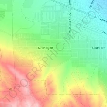
Nome: Mapa topográfico Taft Heights, altitude, relevo.
Local: Taft Heights, Taft, Kern County, California, United States (35.12960 -119.47860 35.13679 -119.46470)
Altitude média: 368 m
Altitude mínima: 274 m
Altitude máxima: 493 m
Taft Heights (formerly, Boust City) is a census-designated place (CDP) in Kern County, California, United States. Taft Heights is located 1 mile (1.6 km) west-southwest of Taft, at an elevation of 1,178 feet (359 m). The population was 1,949 at the 2010 census, up from 1,865 at the 2000 census.