

Mapa topográfico Panvel
Clique no mapa para exibir a altitude.
Panvel
Matheran is a hill station and a municipal council in the Raigad district in the Indian state of Maharashtra. It is a hill station in Karjat Tahsil and is also the smallest hill station in India. It is located on the Western Ghats range at an elevation of around 800 m (2,625 feet) above sea level. It is located around 90 km from Mumbai, and 120 km from Pune. Matheran's proximity to many metropolitan cities makes it a popular weekend getaway for urban residents. The Matheran Mountain can be easily viewed from certain areas in Panvel. One can trek matheran from Dhodani village in panvel. The name Matheran means "forest on the forehead" (of the mountains).
Sobre este mapa
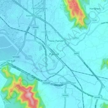
Nome: Mapa topográfico Panvel, altitude, relevo.
Local: Panvel, Raigad, Maharashtra, 410206, India (18.82952 72.96219 19.14952 73.28219)
Altitude média: 75 m
Altitude mínima: -4 m
Altitude máxima: 806 m