

Mapa topográfico Bradgate Park
Clique no mapa para exibir a altitude.
Bradgate Park
Overlying the Beacon Hill Formation, but found a little further down the hillside to the south, are the Bradgate Formation beds, the most notable of which is the Sliding Stone Slump Breccia rocks. Forming a line of crags below Old John, these are laminated mudstones, with layers of sandstone, mainly of volcanic origin. The beds are substantially warped, contorted and folded. Many of the more intricate folds and 'sag' patterns are thought to have occurred while the sediments were unconsolidated and water saturated. Suggested causes for these include slumping, earth tremors and fault-movements, trapped water or gases and volcanic bomb impacts. Outcrops of other rocks of the Bradgate Formation are found further down the slope. These are younger than and stratigraphically above the breccia, but the uplift from ancient mountain-building, the dip of the beds and erosion of overlying rocks mean that the younger rocks are encountered at progressively lower altitudes.
Sobre este mapa
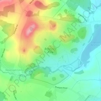
Nome: Mapa topográfico Bradgate Park, altitude, relevo.
Altitude média: 126 m
Altitude mínima: 77 m
Altitude máxima: 209 m
Outros mapas topográficos
Clique em um mapa para visualizar sua topografia, sua altitude e seu relevo.

Old John
United Kingdom > England > Leicestershire > Charnwood > Newtown Linford
Altitude média: 143 m