
Mapa topográfico Big Bear Lake
Mapa interativo
Clique no mapa para exibir a altitude.
Big Bear Lake
Since 1970, Big Bear Lake has held its annual Oktoberfest. The Big Bear Lake Oktoberfest also sports the highest beer garden, by elevation, in the United States. Big Bear Lake was incorporated as a city on November 28, 1980.
Sobre este mapa
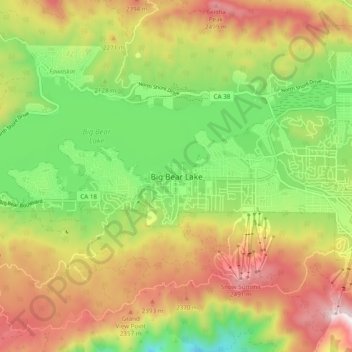
Nome: Mapa topográfico Big Bear Lake, altitude, relevo.
Altitude média: 2184 m
Altitude mínima: 1839 m
Altitude máxima: 2586 m