
Mapa topográfico Lake Coeur d'Alene
Mapa interativo
Clique no mapa para exibir a altitude.
Sobre este mapa
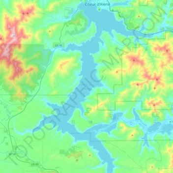
Nome: Mapa topográfico Lake Coeur d'Alene, altitude, relevo.
Altitude média: 827 m
Altitude mínima: 640 m
Altitude máxima: 1579 m
The lake's elevation varies from 2,128 feet (649 m) above sea level in the summer to up to 7 feet (2.1 m) lower in the winter, controlled by the Post Falls Dam 9 miles (14 km) below the lake on the Spokane River.