
Mapa topográfico Ostheim
Mapa interativo
Clique no mapa para exibir a altitude.
Sobre este mapa
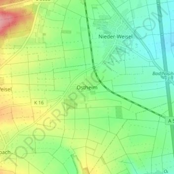
Nome: Mapa topográfico Ostheim, altitude, relevo.
Local: Ostheim, Butzbach, Wetteraukreis, Hessen, 35510, Deutschland (50.38342 8.65203 50.42342 8.69203)
Altitude média: 201 m
Altitude mínima: 160 m
Altitude máxima: 275 m
Bodenrod | Ebersgöns | Fauerbach vor der Höhe | Griedel | Hausen-Oes | Hoch-Weisel | Kirch-Göns | Maibach | Münster | Nieder-Weisel | Ostheim | Pohl-Göns | Wiesental