
Mapa topográfico Rogersville
Mapa interativo
Clique no mapa para exibir a altitude.
Sobre este mapa
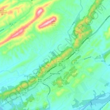
Nome: Mapa topográfico Rogersville, altitude, relevo.
Altitude média: 416 m
Altitude mínima: 324 m
Altitude máxima: 716 m
Rogersville is located slightly southwest of the center of Hawkins County. According to the United States Census Bureau, the town has a total area of 3.4 square miles (8.8 km2), all land. The town is in the valley of Crockett Creek, a southwest-flowing tributary of the Holston River. The elevation of Rogersville is 1,286 feet (392 m). Via U.S. Route 11W (see below), it is 28 miles (45 km) southwest of Kingsport and 65 miles (105 km) northeast of Knoxville.