
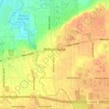
Mapa topográfico Village of Williamsville
Mapa interativo
Clique no mapa para exibir a altitude.
Sobre este mapa
Nome: Mapa topográfico Village of Williamsville, altitude, relevo.
Altitude média: 206 m
Altitude mínima: 181 m
Altitude máxima: 217 m
Outros mapas topográficos
Clique em um mapa para visualizar sua topografia, sua altitude e seu relevo.
North Bailey
United States > New York > Erie County > Town of Amherst
North Bailey, Town of Amherst, Erie County, New York, 14261, United States
Altitude média: 182 m
Swormville
United States > New York > Erie County > Town of Amherst
Swormville, Town of Amherst, Erie County, New York, 14051, United States
Altitude média: 180 m
Getzville
United States > New York > Erie County > Town of Amherst
Getzville, Town of Amherst, Erie County, New York, 14068, United States
Altitude média: 179 m