
Mapa topográfico Virgin
Mapa interativo
Clique no mapa para exibir a altitude.
Sobre este mapa
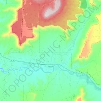
Nome: Mapa topográfico Virgin, altitude, relevo.
Local: Virgin, Washington County, Utah, United States (37.17063 -113.25585 37.26243 -113.14567)
Altitude média: 1251 m
Altitude mínima: 1003 m
Altitude máxima: 1758 m
Virgin is a town in Washington County, Utah, United States. The population was 596 at the 2010 census. The first settlement at Virgin was made in 1858. It is located along the Virgin River (for which it is named), and not far from Zion National Park. The elevation is 3,606 feet (1,099 m). It lies on State Route 9.