
Mapa topográfico Harapanahalli
Mapa interativo
Clique no mapa para exibir a altitude.
Sobre este mapa
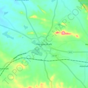
Nome: Mapa topográfico Harapanahalli, altitude, relevo.
Altitude média: 626 m
Altitude mínima: 584 m
Altitude máxima: 757 m
It has an average elevation of 633 metres (2076 feet) away from the sea level. Harapanahalli is surrounded by several districts like Davanagere in the South, Chithradurga in the Southeast, Haveri in the West. Harapanahalli had operated under Bellari, Davanagere districts and Now it is operating under Vijayanagara District.