
Mapa topográfico Campo de Criptana
Mapa interativo
Clique no mapa para exibir a altitude.
Sobre este mapa
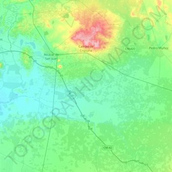
Nome: Mapa topográfico Campo de Criptana, altitude, relevo.
Altitude média: 658 m
Altitude mínima: 625 m
Altitude máxima: 775 m
The 13th century beginnings of the urban center were situated around a fortified position in the Cerro de La Paz, which served as a defensive outpost of the Castillo de Criptana. The topographical features of the area determined the formation of the city and its subsequent expansion into the plain to the south.