Mapa topográfico حومه شهر مرودشت
Mapa interativo
Clique no mapa para exibir a altitude.
Sobre este mapa
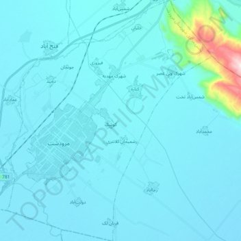
Nome: Mapa topográfico حومه شهر مرودشت, altitude, relevo.
Altitude média: 1633 m
Altitude mínima: 1584 m
Altitude máxima: 2347 m

Clique no mapa para exibir a altitude.
Nome: Mapa topográfico حومه شهر مرودشت, altitude, relevo.
Altitude média: 1633 m
Altitude mínima: 1584 m
Altitude máxima: 2347 m