Mapa topográfico Aluva
Clique no mapa para exibir a altitude.
Aluva
Aluva Railway Station (IR Code: AWY) is a grade-A railway station in Kerala, and is the third busiest railway station in Kochi after Ernakulam Junction railway station and Ernakulam Town railway station. All passenger and express trains bound to southern Kerala have a stop at it. People travelling from the Idukki district must also use either the Aluva railway station or the Tripunithura railway station for all their train journeys, since the Idukki district's topography cannot accommodate a railway station. There are no trains with routes that start or end at the Aluva Railway Station. Aluva Railway Station is situated at the Railway Station Road junction near the KSRTC stand. The KSRTC stand hosts buses from Ernakulam and City Low Floor buses (with and without A/C) in order to connect the majority of the places in Kerala.
Sobre este mapa
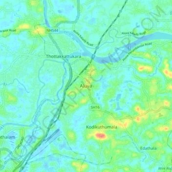
Nome: Mapa topográfico Aluva, altitude, relevo.
Local: Aluva, Ernakulam, Kerala, 683101, India (10.06777 76.31685 10.14777 76.39685)
Altitude média: 11 m
Altitude mínima: -2 m
Altitude máxima: 52 m
Outros mapas topográficos
Clique em um mapa para visualizar sua topografia, sua altitude e seu relevo.