
Mapa topográfico Stuyvesant Falls
Mapa interativo
Clique no mapa para exibir a altitude.
Sobre este mapa
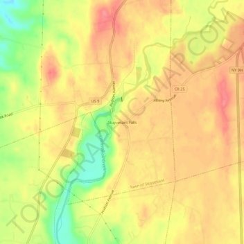
Nome: Mapa topográfico Stuyvesant Falls, altitude, relevo.
Altitude média: 58 m
Altitude mínima: 11 m
Altitude máxima: 84 m
Outros mapas topográficos
Clique em um mapa para visualizar sua topografia, sua altitude e seu relevo.
Nutten Hook State Tidal Wetland
United States > New York > Columbia County > Town of Stuyvesant
Nutten Hook State Tidal Wetland, Town of Stuyvesant, Columbia County, New York, United States
Altitude média: 32 m
Newton Hook
United States > New York > Columbia County > Town of Stuyvesant
Newton Hook, Town of Stuyvesant, Columbia County, New York, 12173, United States
Altitude média: 26 m
Poolsburg
United States > New York > Columbia County > Town of Stuyvesant
Poolsburg, Town of Stuyvesant, Columbia County, New York, 12124, United States
Altitude média: 39 m