
Mapa topográfico Chumbi Valley
Mapa interativo
Clique no mapa para exibir a altitude.
Sobre este mapa
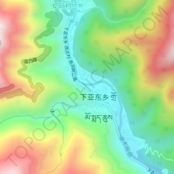
Nome: Mapa topográfico Chumbi Valley, altitude, relevo.
Altitude média: 3076 m
Altitude mínima: 2823 m
Altitude máxima: 3448 m
The valley is at an altitude of 3,000 m (9,800 ft), and being on the south side of the Himalayas, enjoys a wetter and more temperate climate than most of Tibet. The valley supports some vegetation in the form of the Eastern Himalayan broadleaf forests and transitions to the Eastern Himalayan alpine shrub and meadows in the north. The plant Pedicularis chumbica (春丕马先蒿) is named after the valley.