
Mapa topográfico Cherokee
Mapa interativo
Clique no mapa para exibir a altitude.
Cherokee
Cherokee and its surrounding Qualla Boundary is in the very mountainous Swain and Jackson counties. The highest elevation is 6,643-foot (2,025 m) Clingman's Dome at the border with Tennessee. Clingman's Dome is the highest point in the Great Smoky Mountains National Park. The Oconaluftee River flows through downtown Cherokee.
Sobre este mapa
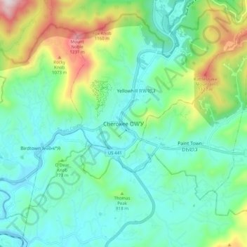
Nome: Mapa topográfico Cherokee, altitude, relevo.
Altitude média: 746 m
Altitude mínima: 554 m
Altitude máxima: 1306 m