
Mapa topográfico Devils Lake
Mapa interativo
Clique no mapa para exibir a altitude.
Sobre este mapa
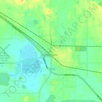
Nome: Mapa topográfico Devils Lake, altitude, relevo.
Altitude média: 443 m
Altitude mínima: 433 m
Altitude máxima: 460 m
The first post office was founded November 15, 1882, and was originally named Creelsburg. It was founded by Lieutenant Heber M. Creel, a West Point graduate and topographical engineer stationed at nearby Fort Totten. After resigning from the U.S. Army, he surveyed the land and established the townsite.
Outros mapas topográficos
Clique em um mapa para visualizar sua topografia, sua altitude e seu relevo.
Channel A
United States > North Dakota > Ramsey County > Grand Harbor
Channel A, Grand Harbor, Ramsey County, North Dakota, United States
Altitude média: 445 m
Six Mile Bay
United States > North Dakota > Ramsey County
Six Mile Bay, Ramsey County, North Dakota, United States
Altitude média: 442 m