
Mapa topográfico East Champaran District
Mapa interativo
Clique no mapa para exibir a altitude.
Sobre este mapa
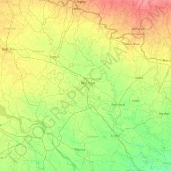
Nome: Mapa topográfico East Champaran District, altitude, relevo.
Local: East Champaran District, Bihar, India (26.25457 84.48528 27.02168 85.29697)
Altitude média: 70 m
Altitude mínima: 50 m
Altitude máxima: 101 m
Raxaul is one of the most significant towns of the East Champaran district. By excellence of its topographical area, it is known as the Gateway to Nepal.
Outros mapas topográficos
Clique em um mapa para visualizar sua topografia, sua altitude e seu relevo.
Sonbhadra
India > Bihar > Sonbhadra Banshi Suryapur
Sonbhadra, Sonbhadra Banshi Suryapur, Arwal District, Bihar, 824120, India
Altitude média: 74 m
Pashchim Champāran
Pashchim Champāran, Pashchim Champaran, Bihar, India
Altitude média: 207 m
Patna
India > Bihar > Patna Rural
Patna, Patna Rural, Patna District, Bihar, 800001, India
Altitude média: 51 m