
Mapa topográfico Snake River
Mapa interativo
Clique no mapa para exibir a altitude.
Sobre este mapa
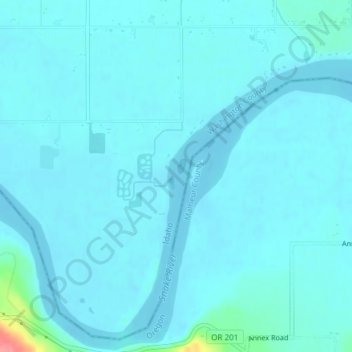
Nome: Mapa topográfico Snake River, altitude, relevo.
Local: Snake River, Washington County, Idaho, United States (44.24055 -117.04422 44.24207 -117.04351)
Altitude média: 643 m
Altitude mínima: 635 m
Altitude máxima: 721 m
Mountain ranges in the Snake watershed include the Teton Range, Bitterroot Range, Clearwater Mountains, Seven Devils Mountains, and the extreme northwestern end of the Wind River Range. Grand Teton is the highest point in the Snake River watershed, reaching 13,775 feet (4,199 m) in elevation. The elevation of the Snake River is 358 feet (109 m) when it joins the Columbia River.[3]
Outros mapas topográficos
Clique em um mapa para visualizar sua topografia, sua altitude e seu relevo.
Midvale
United States > Idaho > Washington County
Midvale, Washington County, Idaho, United States
Altitude média: 794 m
Cambridge
United States > Idaho > Washington County
Cambridge, Washington County, Idaho, United States
Altitude média: 811 m