
Mapa topográfico Emmett
Mapa interativo
Clique no mapa para exibir a altitude.
Sobre este mapa
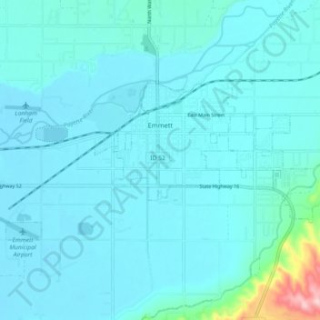
Nome: Mapa topográfico Emmett, altitude, relevo.
Local: Emmett, Gem County, Idaho, United States (43.85026 -116.54272 43.88258 -116.45280)
Altitude média: 738 m
Altitude mínima: 712 m
Altitude máxima: 1000 m
According to the United States Census Bureau, the city has a total area of 2.82 square miles (7.30 km2), of which 2.80 square miles (7.25 km2) is land and 0.02 square miles (0.05 km2) is water. It is located south of the Payette River, at an elevation of 2,362 feet (720 m) above sea level.
Outros mapas topográficos
Clique em um mapa para visualizar sua topografia, sua altitude e seu relevo.
Sweet
United States > Idaho > Gem County
Sweet, Gem County, Idaho, 83670, United States
Altitude média: 811 m