
Mapa topográfico Anthem
Mapa interativo
Clique no mapa para exibir a altitude.
Anthem
Anthem is built on 5,856 acres (9.2 sq mi) at the base of Daisy Mountain and Gavilan Peak. The community's elevation ranges from 1,760 feet to 2,428 feet, with an average elevation of 1,863 feet. Approximately 36 percent of the community is preserved as open space, including 291 acres of open hillside.
Sobre este mapa
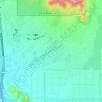
Nome: Mapa topográfico Anthem, altitude, relevo.
Local: Anthem, Maricopa County, Arizona, United States (33.82719 -112.14685 33.87839 -112.08264)
Altitude média: 580 m
Altitude mínima: 521 m
Altitude máxima: 856 m