
Mapa topográfico Bukit Batok Nature Park
Mapa interativo
Clique no mapa para exibir a altitude.
Sobre este mapa
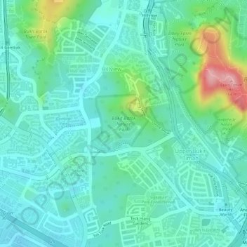
Nome: Mapa topográfico Bukit Batok Nature Park, altitude, relevo.
Altitude média: 45 m
Altitude mínima: 5 m
Altitude máxima: 168 m
The peak of Bukit Batok Hill stands at an elevation of 107m above sea level. Temperature ranges from 23°C to 30°C during "Winter/Wet" season. During Summer, temperature ranges from 24°C to 33°C.
Outros mapas topográficos
Clique em um mapa para visualizar sua topografia, sua altitude e seu relevo.