
Mapa topográfico Gottesberg
Mapa interativo
Clique no mapa para exibir a altitude.
Sobre este mapa
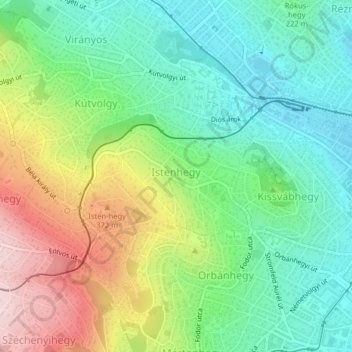
Nome: Mapa topográfico Gottesberg, altitude, relevo.
Altitude média: 247 m
Altitude mínima: 128 m
Altitude máxima: 463 m
Outros mapas topográficos
Clique em um mapa para visualizar sua topografia, sua altitude e seu relevo.
Gellértberg
Gellértberg, Budapest, XI. Bezirk, Mittelungarn, 1114, Ungarn
Altitude média: 126 m
Johannisberg
Johannisberg, XII. Bezirk, Budapest, Mittelungarn, 1021, Ungarn
Altitude média: 343 m
Galgenberg
Galgenberg, XI. Bezirk, Budapest, Mittelungarn, Ungarn
Altitude média: 130 m
Johannisberg
Johannisberg, XII. Bezirk, Budapest, Mittelungarn, Ungarn
Altitude média: 333 m