
Mapa topográfico Graz
Mapa interativo
Clique no mapa para exibir a altitude.
Graz
Graz is situated on both sides of the Mur river in southeast Austria. It is about 150 km (93 mi) southwest of Vienna (Wien). The nearest larger urban centre is Maribor (Marburg) in Slovenia, which is about 50 km (31 mi) to the south. Graz is the state capital and largest city in Styria, a green and heavily forested region on the eastern edge of the Alps. It is located in the Graz Basin and surrounded by mountains and hills to the north, east and west. The city center sits at an elevation of 353 m (1,158 ft), the highest point is Plabutsch mountain with 754 m (2,474 ft) at the western border. The mountain Schöckl is just a few kilometers to the north and surmounts the city by 1,100 m (3,600 ft).
Sobre este mapa
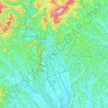
Nome: Mapa topográfico Graz, altitude, relevo.
Local: Graz, Styria, 8011, Austria (46.91087 15.27828 47.23087 15.59828)
Altitude média: 482 m
Altitude mínima: 299 m
Altitude máxima: 1442 m