
Mapa topográfico Sorpetalsperre
Mapa interativo
Clique no mapa para exibir a altitude.
Sobre este mapa
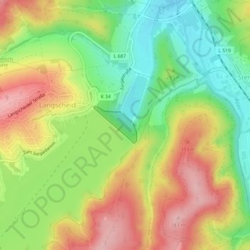
Nome: Mapa topográfico Sorpetalsperre, altitude, relevo.
Altitude média: 289 m
Altitude mínima: 209 m
Altitude máxima: 376 m
Outros mapas topográficos
Clique em um mapa para visualizar sua topografia, sua altitude e seu relevo.
Sorpesee
Deutschland > Nordrhein-Westfalen > Hochsauerlandkreis > Sundern > Stemel
Sorpesee, Stemel, Sundern, Hochsauerlandkreis, Nordrhein-Westfalen, Deutschland
Altitude média: 334 m